Life

Weather 101: Explaining Everyday Phenomena 

Weather 101: Explaining Everyday Phenomena  April 1, 2024Leave a comment

Weather events such as tornadoes, hurricanes, and monsoons are fascinating natural phenomena, but they can seem complex and overwhelming to understand. However, by breaking them down into simpler concepts, we can gain a clearer understanding of these remarkable weather events.

Heatwaves

Shutterstock

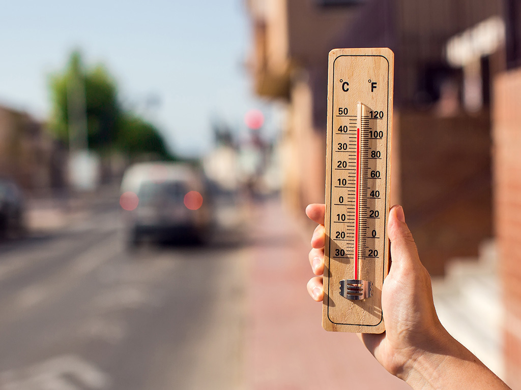
Heatwaves are prolonged periods of excessively hot weather, often associated with high humidity. They can pose health risks and impact agriculture, water resources, and energy consumption. Heatwaves occur due to persistent high-pressure systems and the influx of warm air.

Polar Vortex

Shutterstock

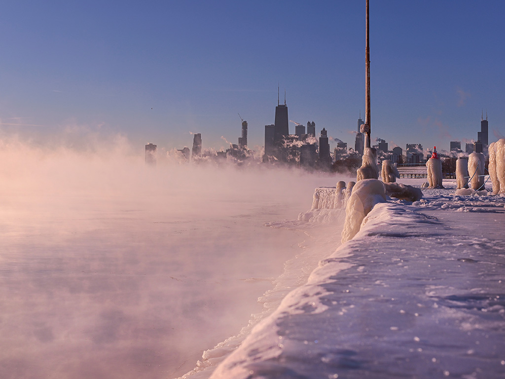
The polar vortex is a large, low-pressure system that resides near the Earth's poles. It weakens during summer and strengthens during winter, sometimes leading to outbreaks of extremely cold air from the Arctic regions into lower latitudes, resulting in severe winter weather events.

Droughts

Shutterstock

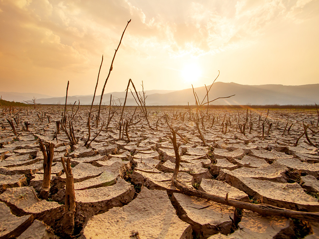
Droughts are prolonged periods of abnormally low precipitation that can occur in various regions globally. They can have severe impacts on agriculture, water supplies, ecosystems, and local economies. Droughts are often associated with persistent high-pressure systems and lack of rainfall.

Storm Surge

Shutterstock

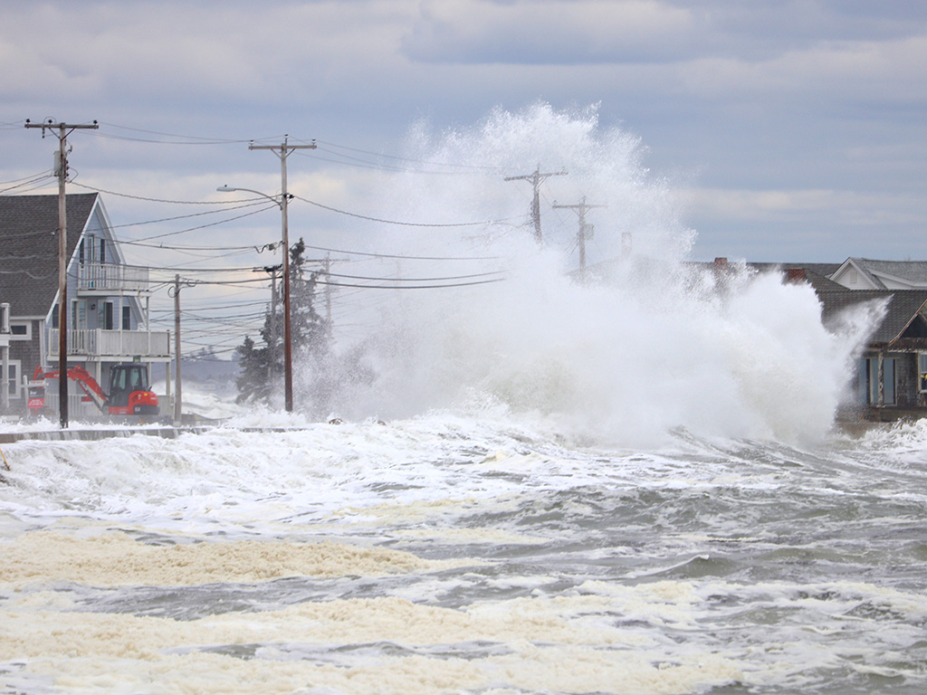
Storm surge is the abnormal rise in sea level caused by a combination of low atmospheric pressure, strong winds, and the push of water towards the shore during a storm, particularly during hurricanes. It poses a significant threat, leading to coastal flooding and erosion.

Jet Streams

Wikimedia Commons / CC0

Jet streams are narrow, fast-flowing air currents in the upper atmosphere that play a crucial role in steering weather systems. They are caused by temperature gradients and pressure differences, with a significant impact on global weather patterns and the movement of storms.

Climate Change Vs. Weather

Shutterstock

Climate change affects global weather patterns by altering temperature, precipitation, and atmospheric circulation. It leads to more frequent and intense extreme weather events, including heatwaves, heavy rainfall, and severe storms.

Tornadoes

Shutterstock

Tornadoes are powerful and destructive rotating columns of air that extend from a thunderstorm to the ground. They form when warm, moist air collides with cool, dry air, creating instability in the atmosphere.

Tornado Formation

Shutterstock

Tornadoes typically form within severe thunderstorms, where strong updrafts and wind shear create a rotating column of air. This rotating air may then descend to the ground, resulting in a tornado.

Tornado Characteristics

Shutterstock

Tornadoes are often characterized by their funnel-shaped cloud, swirling debris, and strong winds that can exceed 300 miles per hour. They can cause significant damage in a short amount of time.

Types of Tornadoes

Shutterstock

Tornadoes can be categorized into different types based on their size and intensity. They range from weak EF0 tornadoes to violent EF5 tornadoes, with the latter causing the most devastation.

Hurricanes

Shutterstock

Hurricanes are large, rotating storms that form over warm ocean waters. They are characterized by strong winds, heavy rain, and a distinct eye at the center. hey are classified by wind speed and the damage they are predicted to cause when they reach land. 

Hurricane Formation

Shutterstock

Hurricanes develop when warm ocean water evaporates and rises, forming thunderstorms. As the warm air continues to rise and cool, it creates a low-pressure area that draws in more warm air, fueling the hurricane's growth.

Anatomy of a Hurricane

Shutterstock

Hurricanes have three main parts: the eye, the eyewall, and the rainbands. The eyewall is a ring of intense thunderstorms surrounding the eye. The eye is a calm, low-pressure center where skies may clear, but dangerous conditions resume in the eyewall. The rainbands consist of curved bands of clouds and thunderstorms that spiral away from the eyewall, capable of producing heavy rain, wind, and tornadoes. 

Hurricane Intensity

Shutterstock

Hurricanes are classified into categories based on their wind speed and potential for damage. Categories range from 1 to 5, with category 5 hurricanes being the strongest and most destructive. Hurricanes reaching Category 3 and higher are considered major hurricanes because of their potential for significant loss of life and damage.

Monsoons

Shutterstock

Monsoons are seasonal shifts in wind patterns that bring a significant change in weather conditions. They often feature heavy rainfall and occur in specific regions around the world. Monsoons always blow from cold to warm regions and are often accompanied by large scale sea or ocean breezes.

Monsoon Formation

Wikimedia Commons / PlaneMad / CC 3.0

Monsoons are primarily caused by temperature differences between land and ocean. During a monsoon, warm air rises over the land, drawing in cooler air from the ocean, resulting in a shift in wind direction. Monsoons can be both helpful and harmful. The rains they bring are important for crop production. However, when monsoons are stronger or weaker than normal, there can be significant problems with food security and crop production. 

Characteristics of Monsoons

Shutterstock

Monsoons are known for their distinct wet and dry seasons. During the wet phase, they bring heavy rain and can cause flooding, while the dry phase is marked by significantly reduced rainfall. Monsoons occur all over the world, but they are more pronounced in certain regions. These regions include: India and South Asia, Australia, Malaysia, and the southwest coastal regions of the United States.

Lightning and Thunderstorms

Shutterstock

Lightning and thunderstorms often accompany weather phenomena such as tornadoes, hurricanes, and monsoons. They are a result of the interaction between warm and cold air, creating intense electrical discharges.

What Causes Lightning?

Shutterstock

Lightning is caused by the buildup of electrical charges within a thunderstorm cloud. The negative charges in the cloud are attracted to the positive charges on the ground, and the cloud releases a strong, negatively charged electrical current. When the charges become strong enough, they discharge as a visible flash of light, followed by the sound of thunder.

Thunderstorm Formation

Shutterstock

Thunderstorms form when warm, moist air rises and meets cooler air, causing instability and the formation of cumulonimbus clouds. These clouds can produce heavy rain, hail, strong winds, and lightning.

Hailstorms

Shutterstock

Hailstorms occur when strong updrafts in thunderstorms carry raindrops upward into freezing temperatures. The water droplets freeze into ice and are then coated with additional layers of ice as they continue to be carried back up by updrafts.

Microbursts

Wikimedia Commons / Public Domain

Microbursts are intense, localized downdrafts of air that can occur within thunderstorms. They produce a sudden and powerful burst of damaging winds, often lasting 5-15 minutes, and can cause significant damage to structures.

Waterspouts

Wikimedia Commons / CC0

Waterspouts are tornadoes that form over water bodies, such as oceans or lakes. They are typically weaker than tornadoes on land but can still be dangerous to watercraft and swimmers, so if you hear about upcoming waterspouts on your local weather forecast, prepare to take cover quickly.

Blizzard Conditions

Shutterstock

Blizzard conditions occur when heavy snowfall, strong winds, and reduced visibility combine to create dangerous winter weather. They can result in whiteout conditions and pose hazards to transportation and outdoor activities.

Wind Shear Effects

Wikimedia Commons / CC 3.0

Wind shear refers to the change in wind speed or direction with altitude. It can have significant effects on weather events, including the formation and intensification of tornadoes, hurricanes, and severe thunderstorms.

Warm Fronts

Wikimedia Commons / Public Domain

If warm air moves in such a way that it advances onto and replaces the cooler air in its path, the leading edge of the warm air mass found at the earth's surface (the ground) is known as a warm front. When a warm front passes through, the weather becomes noticeably warmer and more humid than it was before. The weather map symbol for a warm front is a red curved line with red semi-circles. The semi-circles point in the direction the warm air is moving.

Cold Fronts

Wikimedia Commons / Public Domain

If a cold air mass spills onto and overtakes a neighboring warm air mass, the leading edge of this cold air will be a cold front. When a cold front passes through, the weather becomes significantly colder and drier. It isn't uncommon for air temperatures to drop 10 degrees Fahrenheit or more within an hour of a cold frontal passage. The weather map symbol for a cold front is a blue curved line with blue triangles. The triangles point in the direction the cold air is moving.

Stationary Fronts

Wikimedia Commons / Public Domain

A stationary front is one that is not moving (i.e. the two air masses on either side are not moving perpendicular to the front – one is not displacing the other). This is depicted by an alternating red and blue line with triangles on the blue portion pointing away from the cool air mass and half-moons on the opposite side of the red portion of the line, pointing away from the warm front. A cold or warm front that stops moving becomes a stationary front. The difference in temperature and wind direction between either side of a stationary front is generally not large, but sometimes can be stark.

Occluded Fronts

Wikimedia Commons / Public Domain

Sometimes a cold front will "catch up" to a warm front and overtake both it and the cooler air out ahead of it. If this happens, an occluded front is born. Occluded fronts get their name from the fact that when the cold air pushes underneath the warm air, it lifts the warm air up from the ground, which makes it hidden, or "occluded." The symbol for an occluded front is a purple line with alternating triangles and semi-circles (also purple) pointing in the direction the front is moving.

Dry Lines

Wikimedia Commons / Public Domain

What about boundaries between air masses of different humidity? Known as dry lines, or dew point fronts, these weather fronts separate warm, moist air masses found ahead of the dry line from hot, dry air masses found behind it. In the U.S., they're most often seen east of the Rocky Mountains across the states of Texas, Oklahoma, Kansas, and Nebraska during spring and summer. Thunderstorms and supercells often form along dry lines, since the drier air behind them lifts up the moist air ahead, triggering strong convection. On surface maps, the symbol for a dry line is an orange line with semi-circles (also orange) that face toward humid air.

El Niño and La Niña

Shutterstock

El Niño and La Niña are climate patterns that can influence global weather patterns. El Niño is characterized by warmer than average ocean temperatures in the Pacific, while La Niña denotes cooler than average ocean temperatures.

What is El Niño?

Wikimedia Commons / Public Domain

El Niño can lead to changes in atmospheric circulation patterns, resulting in variable weather conditions worldwide. It is associated with increased precipitation in some regions and drought conditions in others.

What is La Niña?

Shutterstock

La Niña weather conditions often bring stronger trade winds, cooler ocean temperatures, and altered precipitation patterns. It can cause more frequent and intense hurricanes, as well as dryer weather in certain regions.

Weather Radar

Shutterstock

Weather radar systems use radio waves to detect and track precipitation, providing valuable data for forecasting and monitoring weather patterns. They can detect the location, intensity, and movement of precipitation particles.

Satellite Imagery

Shutterstock

Satellites orbiting Earth capture images and data that meteorologists analyze to monitor weather conditions globally. Satellite imagery helps track the development and movement of weather systems and provides valuable information for forecasting.

Numerical Weather Prediction Models

Wikimedia Commons / Public Domain

Numerical Weather Prediction (NWP) models use complex mathematical equations to simulate and forecast the atmosphere's behavior. These models factor in various meteorological data, such as temperature, humidity, wind, and pressure, to make predictions.

Weather Balloons

Shutterstock

Weather balloons carry instruments and sensors into the atmosphere to collect data on temperature, humidity, pressure, and wind speed and direction. The data collected from these balloons helps improve weather forecasting models and provides valuable information for atmospheric research.

Weather Forecasting Tools and Apps

Shutterstock

Various tools and apps are available to access weather forecasts easily. These tools combine data from meteorological agencies, satellites, radars, and models to provide users with accurate and up-to-date weather information for their specific locations.

Importance of Weather Education

Shutterstock

Understanding weather phenomena and the science behind them is crucial for staying safe and making informed decisions. Educating ourselves about weather conditions and forecast accuracy helps us better prepare for and respond to various weather events.

Trusting Reliable Sources

Shutterstock

When seeking weather information, it is essential to rely on reputable sources such as meteorological agencies, weather broadcasters, and official weather websites. These sources use scientific data and expertise to provide reliable and accurate forecasts for informed decision-making.