Life

Explaining Meteorology: The Science Behind Weather Prediction

Explaining Meteorology: The Science Behind Weather Prediction April 1, 2024Leave a comment

Your daily routine probably involves checking the weather at some point, whether you’re looking at your phone’s weather app before you leave the house or you look outside before you get dressed to see if it’s raining or not. But meteorologists do a lot more than just looking up at the sky, and it’s part of the reason why weather prediction has gotten so accurate over time.

What Do Meteorologists Do?

Shutterstock

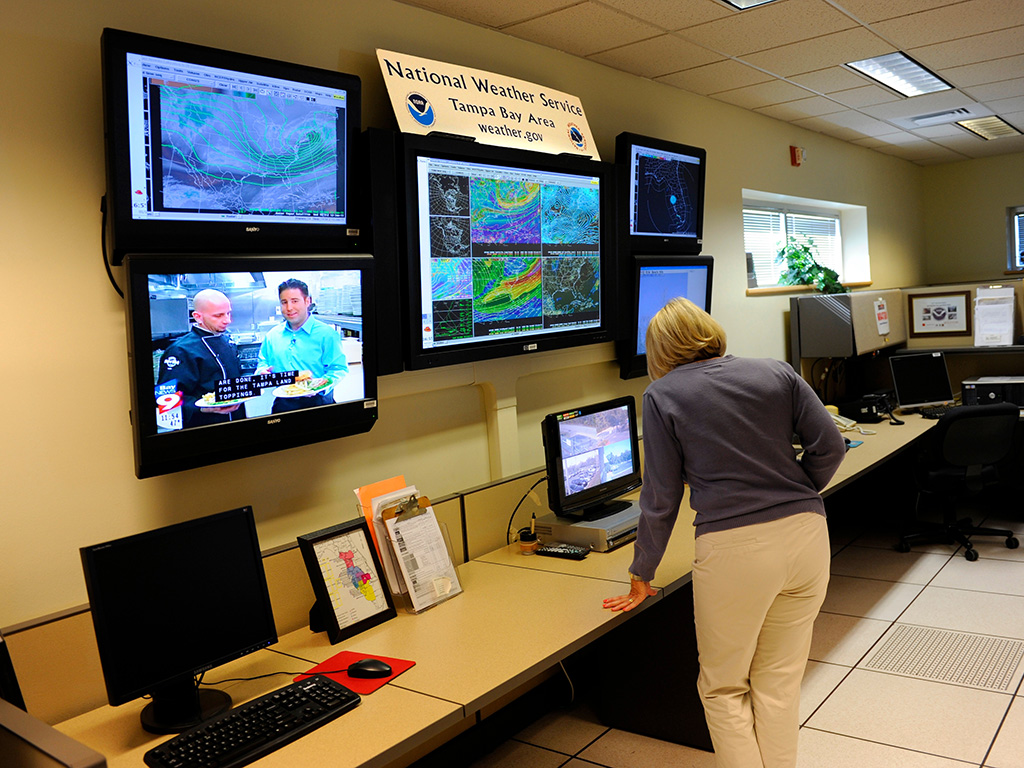
Meteorologists, who are also called forecasters, are scientists who study patterns and atmospheric conditions. They compile data from thousands of observation sites and examine what has occurred in the last 24 hours. Most local weather is determined by location or the geographic conditions of the area.

Forecasting Tools

Shutterstock

This detailed information begins with various forecasting tools meteorologists have at their disposal. This involves using tools such as satellites, radar, and surface maps. Meteorologists look at patterns in the atmosphere, beginning with general patterns, then narrowing it down to the more specific details. We've all heard of satellites and radar, but you might not be familiar with surface maps.

Surface Maps

Shutterstock

Surface maps indicate certain weather components like areas of high pressure or low pressure. High pressure brings us good weather, such as those clear summer skies, whereas low pressure gives us those stormy days and nights in the spring. You might be familiar with surface maps if you watch the weather during local news reports. 

Limitations of Weather Prediction Models

Shutterstock

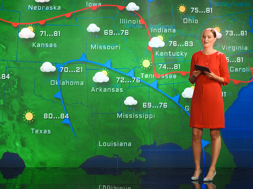
Weather prediction methods have gotten more accurate through the years, but this doesn’t mean that any method of predicting the weather is 100% accurate. The accuracy of weather prediction models decreases as the forecast timeframe extends beyond a few days. Additionally, the models heavily rely on vast amounts of input data, including temperature, pressure, and humidity readings. Any inaccuracies or missing data points can impact the overall accuracy of the forecast. 

Despite these limitations, meteorologists are continually working to improve the models by refining algorithms, incorporating more accurate data sources, and enhancing our understanding of atmospheric dynamics.

The Role of Satellites and Radars

Shutterstock

Satellites and radars play a crucial role in weather reporting, providing meteorologists with invaluable data to monitor and forecast weather conditions. Satellites enable the collection of a wide range of information about Earth's atmosphere, including cloud cover, precipitation, and the movement of weather systems. They provide a global perspective by capturing data from remote regions and oceans that would otherwise go unnoticed. This satellite data is fed into weather models, helping improve the accuracy of forecasts.

Radars Help Predict Local Weather

Shutterstock

On the other hand, radars play a more localized role, providing real-time information on precipitation and severe weather phenomena such as thunderstorms and tornadoes. They use radio waves to detect the size, shape, and movement of precipitation particles, allowing meteorologists to track storms and issue timely warnings. Together, satellites and radars provide a comprehensive view of Earth's weather patterns, enabling meteorologists to make accurate predictions and keep communities informed about potential oncoming hazards.

Improving Weather Forecasts

Shutterstock

There are ongoing efforts to improve weather forecasts and enhance their accuracy. Advancements in data analytics and modeling techniques may play a crucial role. Sophisticated computer models use complex algorithms to process vast amounts of data and simulate weather patterns, helping meteorologists make more accurate predictions. As technology continues to evolve, along with increased understanding of atmospheric dynamics, we can look forward to more reliable and timely weather forecasts in the future.

Weather Forecasting Myths

Shutterstock

Weather forecasting is a complex science, but it has its fair share of myths and misconceptions. One popular misconception is that smartphones can control the weather, often fueled by hoax apps claiming to have such capabilities. In reality, smartphones are incapable of altering atmospheric conditions. Debunking these myths helps to promote accurate understanding of weather and reminds us to rely on trusted sources of information, such as meteorological agencies and trained forecasters.

Forecasting Myth: Cloudbusting

Shutterstock

One persistent forecasting myth is the concept of "cloudbusting," which suggests that certain individuals or technologies have the ability to control or manipulate the weather. This idea gained popularity through the works of Wilhelm Reich, who claimed to have developed a device capable of influencing cloud formation. However, there is no scientific evidence to support the notion that humans can alter weather patterns on a large scale. While cloud seeding is a legitimate technique used in some regions to enhance precipitation in drought-stricken areas, it is limited in its scope and effectiveness. 

Don’t Trust Long-Range Predictions

Shutterstock

One common myth is that long-range weather predictions are highly accurate. In reality, forecasting beyond a few days is challenging due to the inherent chaotic nature of the atmosphere. Another myth is that animals can predict impending weather changes. While animals may exhibit certain behaviors before weather events, it is mostly a coincidence and not a reliable forecasting method.

Famous Weather Forecasting Failures

Shutterstock

Throughout history, there have been several notable instances where weather forecasting has experienced significant failures. One such instance was the "Great Storm of 1987" in the United Kingdom. Forecasters failed to predict the severity of the storm, resulting in widespread damage and loss of life. 

Forecasting Fails: “Snowmageddon” 2010

Wikimedia Commons / AgnosticPreachersKid / CC 3.0

The winter storm known as "Snowmageddon," which hit the Eastern United States in February 2010, stands as a remarkable example of a weather forecasting failure. The storm caught meteorologists off guard, leading to significant disruptions and chaos in major cities like Washington, D.C., New York, and Philadelphia. Forecasters initially predicted a mere chance of light snow, failing to grasp the magnitude and intensity of the approaching storm. As a result, the region was ill-prepared, with insufficient measures taken to handle the significant snowfall and blizzard conditions. 

Forecasting Fails: Hurricane Reporting

Shutterstock

In recent times, the failure to accurately predict the path and intensity of hurricanes, such as Hurricane Katrina in 2005 and Hurricane Sandy in 2012, resulted in devastating consequences. These failures have led to increased scrutiny of forecast models, improvements in data collection, and enhancements in communication between meteorologists and the public. 

The Future of Weather Prediction

Shutterstock

The future of weather prediction looks promising, with advancements in technology and scientific understanding paving the way for more accurate and detailed forecasts. One key area of development is the integration of artificial intelligence (AI) and machine learning into forecasting models. These technologies enable meteorologists to analyze vast amounts of data more efficiently, identify patterns, and make more precise predictions. 

Understanding Weather Reports: Warm Fronts

Wikimedia Commons / Public Domain

If warm air moves in such a way that it advances onto and replaces the cooler air in its path, the leading edge of the warm air mass found at the earth's surface (the ground) is known as a warm front. When a warm front passes through, the weather becomes noticeably warmer and more humid than it was before. The weather map symbol for a warm front is a red curved line with red semi-circles. The semi-circles point in the direction the warm air is moving.

Cold Fronts

Wikimedia Commons / Public Domain

If a cold air mass spills onto and overtakes a neighboring warm air mass, the leading edge of this cold air will be a cold front. When a cold front passes through, the weather becomes significantly colder and drier. It isn't uncommon for air temperatures to drop 10 degrees Fahrenheit or more within an hour of a cold frontal passage. The weather map symbol for a cold front is a blue curved line with blue triangles. The triangles point in the direction the cold air is moving.

Stationary Fronts

Wikimedia Commons / Public Domain

A stationary front is one that is not moving (i.e. the two air masses on either side are not moving perpendicular to the front – one is not displacing the other). This is depicted by an alternating red and blue line with triangles on the blue portion pointing away from the cool air mass and half-moons on the opposite side of the red portion of the line, pointing away from the warm front. A cold or warm front that stops moving becomes a stationary front. The difference in temperature and wind direction between either side of a stationary front is generally not large, but sometimes can be stark.

Occluded Fronts

Wikimedia Commons / Public Domain

Sometimes a cold front will "catch up" to a warm front and overtake both it and the cooler air out ahead of it. If this happens, an occluded front is born. Occluded fronts get their name from the fact that when the cold air pushes underneath the warm air, it lifts the warm air up from the ground, which makes it hidden, or "occluded." The symbol for an occluded front is a purple line with alternating triangles and semi-circles (also purple) pointing in the direction the front is moving.

Dry Lines

Wikimedia Commons / Public Domain

What about boundaries between air masses of different humidity? Known as dry lines, or dew point fronts, these weather fronts separate warm, moist air masses found ahead of the dry line from hot, dry air masses found behind it. In the U.S., they're most often seen east of the Rocky Mountains across the states of Texas, Oklahoma, Kansas, and Nebraska during spring and summer. Thunderstorms and supercells often form along dry lines, since the drier air behind them lifts up the moist air ahead, triggering strong convection. On surface maps, the symbol for a dry line is an orange line with semi-circles (also orange) that face toward humid air.

Forecasting Models

Shutterstock

The next step that forecasters use is to look at computer forecasting models, which show different scenarios of what might happen with the weather. Every day, millions of observations from satellites are recorded into these models, and they are frequently updated to improve future weather forecasting. Meteorologists have dozens of these models to look at, each of which can produce a different result every time atmospheric conditions are altered slightly. This collection of models, called a model ensemble, gives meteorologists an even greater number of possible predictions.

Predicting the Future with Forecasting Models

Shutterstock

For example, one model may predict a day of mostly sunny skies. But if a meteorologist increases the wind speed slightly, the model may show mostly cloudy or even rainy skies later in the day. Or if rain is predicted on a cold spring day, a slight drop in temperature could change that rain to sleet or even snow, which probably isn't something we want to see in the spring!

Weather Forecasting Myths Debunked

Shutterstock

It is important to rely on scientific meteorological data and forecasts from trusted sources instead of these myths when making weather-related decisions. While some weather myths have gained credibility over the years, others remain popular despite the fact that they aren't true! Always check your local weather report instead of relying on a saying that you only half-remember.

Red Sky at Night, Sailor's Delight

Shutterstock

This myth suggests that if the sky is red at sunset, the weather will be calm and pleasant the following day. However, the color of the sky is not a reliable predictor of weather conditions. It is influenced by the scattering of light due to particles in the atmosphere and can vary based on location and time of year.

Full Moon Causes Weather Extremes

Shutterstock

There is a common belief that a full moon leads to weather extremes such as storms or significant temperature variations. However, scientific studies have found no significant correlation between a full moon and weather patterns. Weather is primarily influenced by atmospheric conditions and larger-scale weather systems.

Cows Lying Down Means Rain

Shutterstock

It is often said that if cows are lying down in a field, it indicates that rain is on the way. However, cattle behavior is influenced by various factors, such as temperature, humidity, and comfort. While changes in weather conditions can impact their behavior, it is not a reliable indicator of imminent rain.

Frogs Can Predict Rain

Shutterstock

The notion that frogs croaking louder or more frequently indicates rain is a common myth. Frogs sing for various reasons, including mating calls and establishing territory. While they may respond to changes in atmospheric pressure before precipitation, they are not a reliable source of weather forecasting.

Summer Thunderstorms Only Happen in the Afternoon

Shutterstock

While it is true that thunderstorms are more common during the warmest parts of the day, they can occur at any time. Thunderstorms can develop due to a combination of atmospheric instability, moisture, and lifting mechanisms, which can vary from one location to another.

Hair Frizz as a Rain Indicator

Shutterstock

There is a myth that frizzy hair indicates rain in the forecast. While high humidity levels can cause hair to become frizzy, it is not a reliable indicator of imminent rain. Frizzy hair is a result of moisture in the air, and rain may or may not occur even with frizzy hair.

Seagulls Flying Inland

Shutterstock

It is often said that seagulls flying inland is a sign of bad weather on its way. However, seagulls and other birds change their flight patterns for various reasons, such as searching for food or avoiding predators. Their behavior is not a reliable indicator of specific weather conditions.

Groundhog Day

Shutterstock

The belief that a groundhog's behavior on February 2nd, specifically whether it sees its shadow or not, can predict the arrival of spring is a common myth. In reality, the groundhog's behavior is determined by local conditions and has no scientific correlation to the change of seasons.